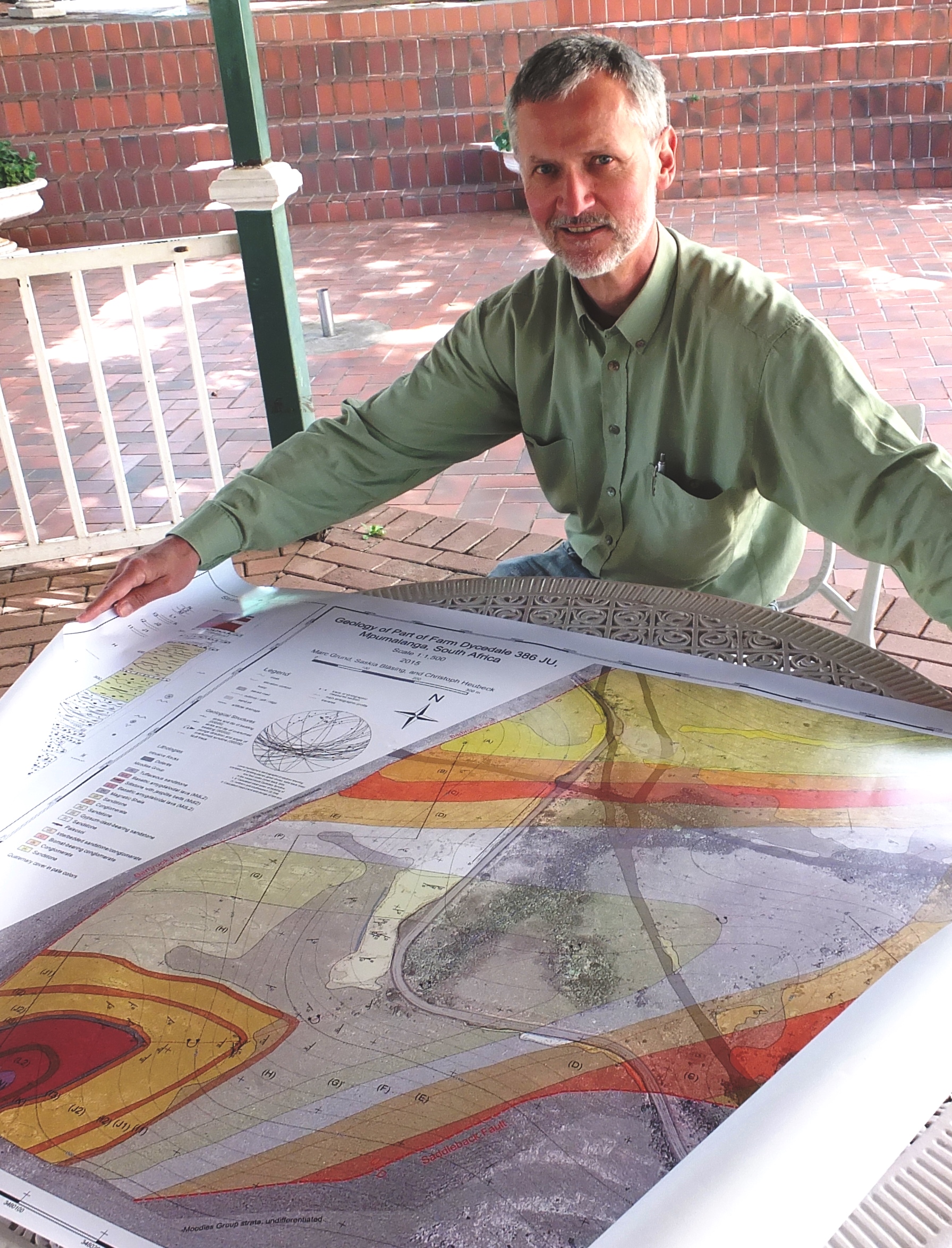
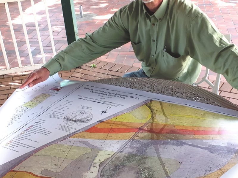
Prof Christoph Heubeck with a copy of the new map
Slowly but surely a detailed picture of the geology of Mountainlands Nature Reserve is being unveiled thanks to the efforts and contributions of Prof Christoph Heubeck from Jena University and students from this university and from his former workplace, the Freie Universität Berlin, Germany. Recently, Prof Heubeck presented us with a new geological map of the western part of Farm Dycedale, accompanied by the supporting bachelor theses of two students from the Freie Universität Berlin.

Saskia Bläsing and Marc Grund discussing their work with a group of Japanese geologists on the Barberton Makhonjwa Geotrail. (photo courtesy of Prof C. Heubeck. )
Saskia Bläsing and Marc Grund, both from the Freie Universität Berlin, had spent ten days last winter scouring a small, but beautifully exposed part of the reserve, containing strata of the Moodies Group which dates back a staggering 3.2 billion years. The strata, deformed in a half-cylindrical, downward-bent shape called a syncline, host evidence for the existence of microbial communities called biomats (some of the first life forms that one can see with the naked eye) which lived in a shallow-marine and tidal sandy environment.
Marc and Saskia studied the compositions of the strata and their sedimentary structures and inferred the processes of deposition of this approximately 1 square-kilometre area. “In the process of mapping, my students discovered that the biomats are closely associated with gravel which indicates the rapid and very erosive flow of water. Surprisingly, these early life forms appear to have been very well adapted to this extreme environment which suggests that the harsh living conditions among moving sand and gravel must have been more than balanced by a gained evolutionary advantage, possibly the access to water, nutrients, and sunlight”, said Prof Heubeck.
Until the students mapped the area, several comprehensive maps of the entire Barberton Greenstone Belt had included this but very little detail of this specific area had been documented. “Due to the accessibility of the Dycedale Syncline from the R40 road and the frequency by which geological field trips pass through the area, the area will serve as an instructive archive to understand Archaean surface processes. We felt the time had come to compile this map in order to provide geologists and laypersons with information and to fill a gap in our understanding of greenstone belt evolution during Moodies time,” said Prof Heubeck.
At the latest, the new map will certainly make a notable contribution in August and September of 2016, when two high-profile field trips of the 35th International Geological Congress will visit this region to learn about early Earth.
BKonnek says:
Reblogged this on Eldorado Community Projects and commented:
Understanding Archaean surface processes @Mountainlands Nature Reserve #Barberton Greenstone Belt